Aug 1 2009

bearchel

The day we left Jasper we had perfect weather.  The sky was blue and the air was clear, no sign of the smoke from the wild fires in British Columbia.  During our drive on the Icefield Parkway, I took  what I think are the best pictures of my trip so far.  It’s quite easy to do when the scenery is so beautiful but I must say that no picture will ever do justice to such beauty.

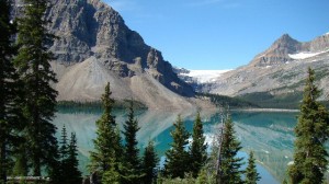
Taken at Waterfowl Lake,  in Banff National Park

Taken at Waterfowl Lake, in Banff National Park

Another view of Waterfowl Lake,  along the Icefield Parkway

Another view of Waterfowl Lake, along the Icefield Parkway

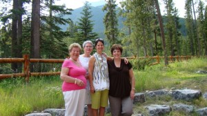
The first day of our visit, we went to Canmore AB, a little town about 20 minutes from Banff, but outside of Banff National Park.  My cousin Joe-Anne, who lives in Calgary, has a condo there, and we went to see her.  By pure luck, my cousin Andrée (Joe-Anne’s sister) and my aunt Thérese (her mother and my  mom’s sister) had arrived the day before from Montréal.  We met at her condo where we took this family picture

My aunt Thérèse,  my cousin Andrée,  Joe-Anne and me,  in the condo's backyard

My aunt Thérèse, my cousin Andrée, Joe-Anne and me, in the condo's backyard

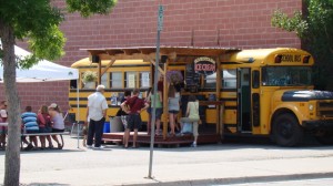
After going to lunch we went downtown Canmore for an ice cream.

A child's dream as far as school buses are concerned ;)

A child's dream as far as school buses are concerned 😉

And that my friends, is  how I keep my round figure… 😉

We had a great time with the family, but Joe-Anne had to go back to Calgary, she was busy preparing a big party for her son’s graduation.  We still had a lot of things to do in Banff NP, so we parted and promised to meet again soon.

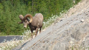
The next day, we took road 1A and we slowly drove to Lake Louise.  On the way we saw some wildlife

Big Horn Sheep

Big Horn Sheep

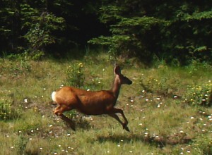
Deer

Deer

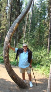
In Jonhston Canyon, I took a picture of Bear leaning against a very flexible tree!…

Just Kidding!  ;)

Just Kidding! 😉

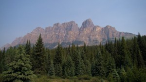
We passed by Castle Cliffs, a landmark for travelers, it appeared on  maps as early as in 1858.  There was an attempt after World War II  to rename this mountain “Mount Eisenhower”, but there was an outcry from locals and travelers alike, the decision was then made to restore the original name, but the tower at the South-East end, popular with climbers,   was named “Eisenhower Peak”.

Castle Cliffs

Castle Cliffs

We made it to Lake Louise around lunch time

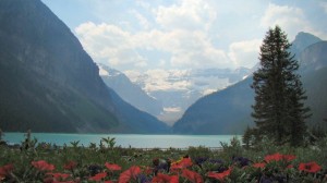
View of Lake Louise from the dining room in Château Lake Louise

View of Lake Louise from the dining room in Château Lake Louise

We had lunch in the dining room of  Château Lake Louise.

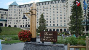
Château Lake Louise

Château Lake Louise

They serve the most delicious sauce to eat with french fries, it is called “Black pepper Truffle Aioli” sauce.  Dude! we wanted to eat it with a spoon it was so good!  Everything else was also great, but that sauce… man!  It was as good as the view!

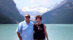
After lunch, we took a stroll along the edge of the lake, and someone graciously offered to take our picture

Just us...   hiding a beautiful view

Just us... blocking a beautiful view

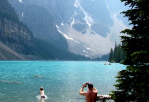
Stomachs full, we left Lake Louise and went to neary Lake Moraine.

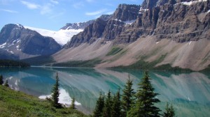
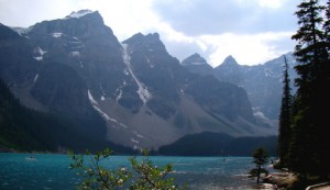
Lake Moraine

Lake Moraine

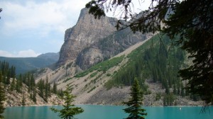
Another view of Lake Moraine

Another view of Lake Moraine

The turquoise color of the glacier-fed lakes is due to the “rock flour” brought in by melting waters.  The heavy particles which turn the water milky in rivers, sink to the bottom, and leave the lighter particles suspended.  These  particles  absorb all light, except for blue and green which are reflected to us.  In the winter, there is less melt, the water is more blue, in the summer, more turquoise.

I finally proved one of my “theories” at Moraine Lake.  You see, I am convinced that modern kids do not feel pain or cold the way we did.  This is based on the fact that kids seem to enjoy piercing just about every sensitive part of their bodies, on top of that, they do not dress warmly when it is cold outside.  I do have a proof now! The water in Moraine Lake and other glacier-fed lakes in the Canadian Rockies never goes above 7 degree Celsius (about 40 F).  And what is that kid doing in that 40 degree water?

Yup! that's the proof,  right there friends!

Yup! that's the proof, right there friends!

Swimming…. he was swimming… a recipe for hypothermia for any normal grown-up human being!

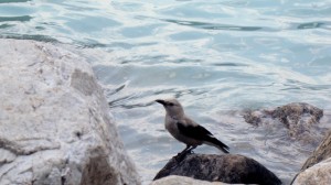
Finally, I have another bird for you to identify, you are doing a good job so far.

My mystery bird in Lake Louise

My mystery bird in Lake Louise

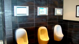
And, another “Only in Canada” shot

How about urinals with private TV screens?  Gotta entertain the boys...

How about urinals with individual TV screens? Gotta entertain the boys...

Last picture courtesy of Bear or course….;)

P.S.  Chicken is part of this post also, you just have to look carefully if you want to find him this time.  After his scary encounter with the Bear Mountie, he decided to stay out of trouble for a little while.

Average Rating: 4.7 out of 5 based on 229 user reviews.


Jul 28 2009

bearchel

We woke up bright and early and left Clearwater to make our way to Jasper AB. Although the road was a fine one, our progress was slow because we were stopping every chance we could get in order to take pictures. Thankfully we had a windshield, because our dropping jaws, in awe of the scenery, left us with mouths wide opened most of the way, and judging by the amount of flies and bugs corpses on the window, there would have been no need for supper, our recommended daily intake of proteins having been met for the day.
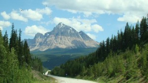
Taken while going down the road,  nice view,  complete with squashed bugs ;)

Taken while going down the road, nice view, complete with squashed bugs 😉

We followed the North Thompson River going up on Hwy 5  and then the Frazier on Hwy 16, that’s where we found a pull-out right next to the river, with a wonderful view of Mount Robson, the tallest mountain in the Canadian Rockies at 12, 972 ft,   and decided that would be a good place for a light lunch.
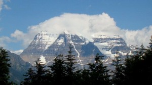
Mount Robson,  with its head in the clouds
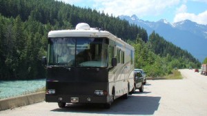
Mount Robson, with its head in the clouds

Parked for lunch next to the Frazier

Parked for lunch next to the Frazier

We arrived in Jasper early afternoon. I was a little apprehensive at the thought of camping with no “hook-ups” for 4 nights. Although the motorhome is self-contained and we can camp without being connected to services, I am not particularly found of it. My idea of “roughing it” is camping with full services, being able to use my washer-dryer and of course, satellite TV and having a Wi-Fi connection make things even sweeter. Turns out, we were fine. Totally disconnected from the world, off the grid, we explored the area all day, and returned, tired but happy. We read a book and then watched a pre-recorded movie before turning in early so we would be in shape for another day of exploration. Jasper turned out to be our favorite part of the Canadian Rockies. Every curve of every road brought a new amazing vista. Turquoise lakes surrounded by snowy peaks, meadows of wild flowers rushing milky-water rivers leading to waterfalls were plentiful.
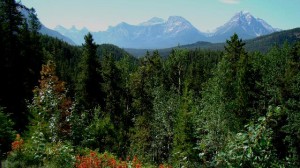
Athabasca pass viewed from the Icefield Parkway

Athabasca pass viewed from the Icefield Parkway

The first day we took the Icefield Parkway, which offers a stunning view of over 100 glaciers on the way to the Columbia Icefield
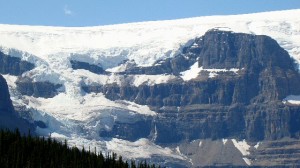
One of the many glaciers visible from the Icefield Parkway

One of the many glaciers visible from the Icefield Parkway

When snow falls year after year on high mountain peaks and plateaus, there is very little summer melt so it accumulates. When the snow is about 100 ft deep, the bottom layer is so pressurized it turns into ice. When more snow falls on top, the ice becomes thicker and thicker, eventually it overflows into the surroundings, flowing downhill. That is how a glacier is born. The intense pressure at the bottom of a glacier causes the ice to become “plastic”. It conforms to the bedrock irregularities without breaking or cracking, but the upper layers are brittle, they crack open into giant crevasses when subjected to stress.
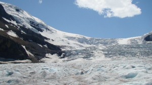
Giant cracks and crevasses on the Athabasca glacier

Giant cracks and crevasses on the Athabasca glacier

The Columbia Icefield is 130 square miles, which makes it the largest body of ice in the Rocky Mountains. Its average elevation is 10, 000 ft and it is estimated that its greatest depth is about 1, 200 feet. It drains into 3 oceans, the Pacific, the Atlantic and the Artic. In order to view it, one would have to take a helicopter tour.

So, we settled on visiting the Athabasca glacier which is easily accessible.
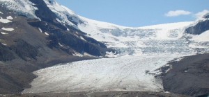
Athabasca Glacier

Athabasca Glacier

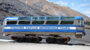
One of the many glaciers fed by the Columbia Icefield it is he only one where you can take an excursion on the surface in a massive Ice Explorer.
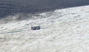
Ice Explorer on the glacier

Ice Explorer on the glacier

Only 23 of these beasts were ever built, and Brewster, our tour company, owns 22, the other one belongs to  US government  and is used in Antarctica to transport scientists. Cool huh? Bear was really impressed when he learned that each tire of this monster-machine costs $5, 000 and there are 6 per vehicle… you do the math.
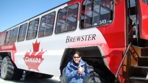
Marianne,  our chauffeur,  was tickled pink at getting her picture taken with Chicken

Marianne, our chauffeur, was tickled pink at getting her picture taken with Chicken

Marianne, our Ice-Explorer driver just completed a Pedagogy Degree at the University of Sherbrooke in Québec. She went on a trip with her girlfriend and fell in love with the area. She also thought it would be really cool to drive the big monster-buses, so she applied and she is now happily teaching everything about the Athabasca glacier to tourists while she drives some of the biggest vehicles in existence today.

After going down a moraine with a 32° slope and driving up the glacier, she let us out. There we were, walking on about a thousand feet deep of ice, some people were drinking the melting waters, we just concentrated on walking without falling on our butt or into a crevasse, but it was one of the coolest things we ever did!
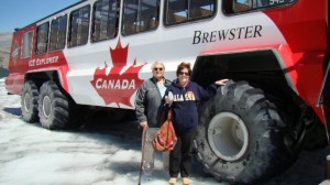
Hanging on,  scared of falling!

Hanging on, scared of falling!

The first Ice-Explorers were giant snowmobiles, without any suspension or opening windows, thus the nickname; “Shake & Bake”.

Shake & Bake

Shake & Bake

Chicken got in trouble again!  This time with a Bear/Mountie who thought he looked delicious!
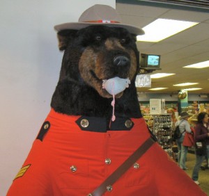
OOOPS!

OOOPS!

The road follows the Athabasca River, its waters milky from all the silt or “rock flour” coming from the melting glacier. It flows north and eventually, the water from the Athabaska finds its way to the Arctic Ocean
Milky waters of the Athabasca river

Milky waters of the Athabasca river

The rushing water carved its way into very pretty falls along the way.
athabaskafalls

The second day we took Maligne rd, which took us all the way to Maligne Lake, where one of the most famous pictures of the Rockies was taken.

On the way, we passed by Medecine Lake.
Medecine lake

Medecine lake

This lake was considered “magic” or “big medecine”  by the Indians because around October, it vanishes being replaced by a shallow stream and a few small pools. The depth of the lake can vary by 20m (65 feet). The lake does not appear to have any visible outlet, so the Indians feared it. The truth is,   this part of the Maligne Valley was severely fractured during the uplift. The water seeped into the cracks and slowly dissolved a network of underground passages. When the cool weather comes, there is less meltwater, the inflow is less than the drainage into the caves, and the lake disappears.

That’s where we were lucky enough to catch a picture of the elusive Pika.
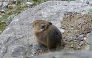
Cute Pika

Cute Pika

This cute animal, the size of a hamster, not a rodent, he is herbivore. He is also called “Rock Rabbit”.  He is quick and blends very well with his surroundings, which makes him very hard to spot. Quickly disappearing, the Pika is being considered for protection under the “Endangered Species Act”.

And then we saw this bird in a tree, I had never seen one like it.
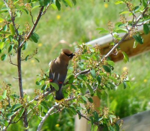
Anybody knows what kind of bird this is?

Anybody knows what kind of bird this is?

Then we had lunch at Maligne Lake, our destination for the day.
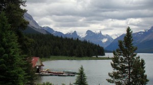
maligne_lake

Maligne lake on a cloudy day

We took a cruise to Spirit Island, where in 1930, a photographer took a black and white picture of the lake and won the Kodak Picture contest that year.  He named the picture Spirit Island because he thought it captured the “spirit” of the Rockies.  He waited 3 days for the perfect conditions for his picture, unfortunately, we had a cloudy day and could not wait that long.
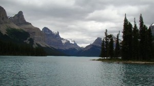
maligne-lake

Taken from Spirit Island

On our way back, we spotted Yogi Bear in his quest for lunch!
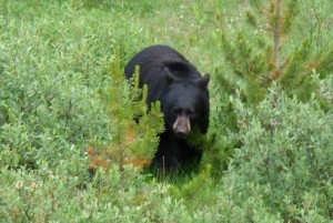
Yogi

Yogi

On  our last day in Jasper NP, we took small roads, had lunch at the Pocahontas Lodge which claims to serve the “best liver and onions dinner in Alberta”.  The Miette rd leads to a Hot Spring, but along the way, there is a lot of wildlife….
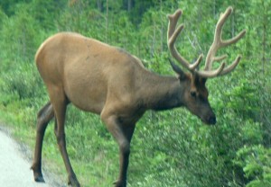
Elk
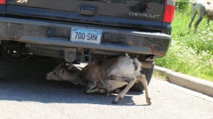
Elk

A crazy goat trying to lick the underside of the car!

A crazy goat trying to lick the underside of the car!

and amazing wild flowers!  The license plate of Alberta reads “Wild Rose Country”.  They grow all over the place.
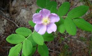
Wild Rose

Wild Rose

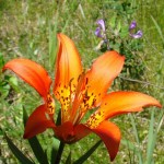
Other gorgeous wild flowers seen along the way
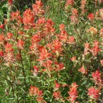
flowerpatch

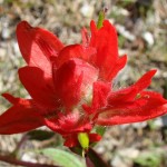
A patch of "Paintbrush"

Paintbrush up close
Paintbrush up close

A beautiful wild Lilly
A beautiful wild Lilly

flower2

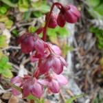
Tiny burst of color

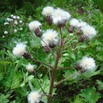
Unknonw specie,  but I thought it was kinda cute!

Unknown specie, but I thought it was kinda cute!

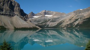
Alas, we had to leave, but we were going to Banff National Park, which promised to be as beautiful and grand as Jasper.   It was a perfect day when we took the road, and we captured some of the best looking pictures so far.
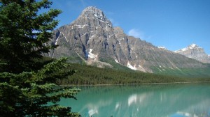
Blue sky and no wind,  perfect for pictures
Blue sky and no wind, perfect for pictures

A feast for the eyes

A feast for the eyes along the Icefield Parkway

Average Rating: 4.6 out of 5 based on 157 user reviews.


Jul 16 2009

bearchel

Cultus Lake is approximately 90 minutes East of Vancouver.  It is a very popular recreational area that offers hiking trails, swimming, boating, fishing and of course, golfing.

Cultus Lake

Cultus Lake

We camped there for 8 days, and despite the fact that we had quite a few rainy days, we had a very good time.  We finally met  Sharry and Al, from Texas.  Bear had been corresponding with them online for a little while and we found out we were going to be in Cultus Lake at the same time!  We spent evenings chatting around a campfire, it was fun and we feel we have made friends for life.

Sharry and Al really enjoyed Chicken's company ;)

Sharry and Al really enjoyed Chicken's company 😉

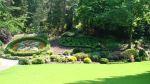
A break in the weather meant going on an excursion and see what we can see.  The first day, we found Minter Gardens in Rosedale.  In 1977, on a family outing, Brian and Faye Minter discovered a unique and picturesque site and decided to create one of the most beautiful gardens in the world.  Their dream became a reality and we can now admire this 32 acres garden set against a magnificient mountain backdrop.

Entrance,  Minter Gardens

Entrance, Minter Gardens

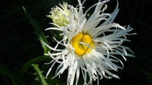
A daisy with a bad hair day!

A daisy with a bad hair day!

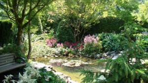
Serene beauty

Serene beauty

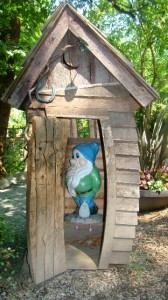
Chicken found a friend hiding in a little garden shed.  They had a good time together.

Chicken and his friend the garden gnome

Chicken and his friend the garden gnome

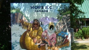
Alas, it was time for chicken to say goodbye to his new friend, and we left Rosedale and made our way to Hope BC.

Bear and Chicken having fun in Hope BC

Bear and Chicken having fun in Hope BC

Hope is the capital of chainsaw woodcarving in BC.  It is also where the movie Rambo “First Blood” with Sylvester Stallone was filmed.  Director Ted Kotcheff, a canadian, really liked the rain forest around Hope, the curious mixture of coniferous and almost southern savannah where everything is covered by moss because it rains all the time.  To him, it looked damp and uncomfortable, and that is what he wanted for the movie.  The misty weather of the small town and the imposing mountains and canyon scenery contributed to the success of the film.  The buildings that were blown up in town during the movie were actually built for the sole purpose of being destroyed, no real building were damaged 🙂

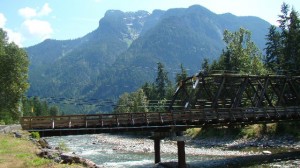
The bridge where Rambo was escorted out of town

The bridge where Rambo was escorted out of town

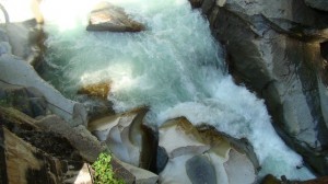
The Coquihalla Canyon near hope was also featured in the film.  The 150 foot fall from a helicopter in a narrow canyon was filmed there.  The stunt man received $14.000 to perform the stunt, he reportedly had agreed to do it for half that amount, but after seeing the helicopter repeatedly blew over the airbags he was set to land on, he doubled his price!  The scene took 6 hours to complete.

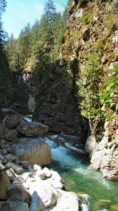
Coquihalla Canyon

Coquihalla Canyon

Rushing water in Coquihalla gorge

Rushing water in Coquihalla gorge

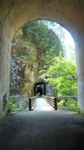
This is also the site of the Othello tunnel.  The 5 tunnels are amazingly perfectly aligned.    Long thought impossible, Andrew McCullough figured out the way to make a passage for the Kettle Valley Railway.  He and his men were lowered in woven baskets from the top with their tools and survey instruments, an from this precarious position, developed the plan for a series of tunnels and bridges.

The tunnels are perfectly

The tunnels are perfectly aligned

The tunnels were accessible by an easy walking trail along the gorge.

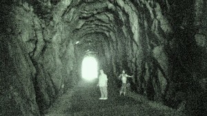
Bear in one of the tunnels

Bear in one of the tunnels

On a cloudy but NOT rainy day, we went to Harrison Springs.

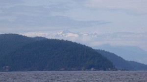
The Village of Harrison Hot Springs has been a small resort community since 1886.  The hot springs are a major atraction and people come to stay at the Spa-resort. The village is situated at the southern-end of Harrison lake.  We took a 2 hour cruise on the lake.

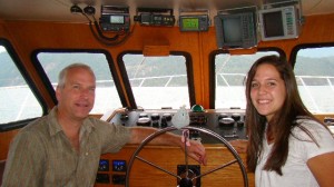
The crew was happy to let Chicken drive the boat

The crew was happy to let Chicken drive the boat

The lake is fed by a glacier on top of Mount Breakenridge

The lake is fed by a glacier on top of Mount Breakenridge

It is said that there is a Tsunami risk here, some geologist believe that an unstable rock face at Mount Breakenridge at the north end of the lake could collapse into the lake and generate a large wave that would destroy the town of Harrison Hot Springs.

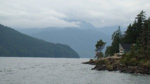
A quiet place,  with no electricity or services,  only accessible by boat.   For those who want to be away from it all.

A quiet place, with no electricity or services, only accessible by boat. For those who want to be away from it all.

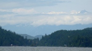
Snow peaks magically appear on top of the clouds

Snow peaks magically appear on top of the clouds

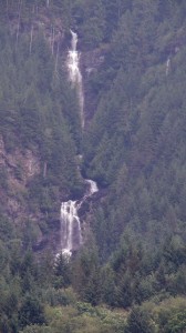
Rainbow falls are 2300ft high, on a sunny day,   a rainbow appears in the mist at the bottom of the falls.

Rainbow Falls

Upper part of Rainbow Falls

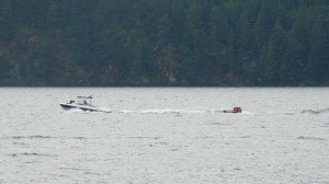
Canadians only enjoy a few months of summer, and they make the most of it.  Even though this lake is fed by glacier water, and the temperature was on the cold side the day we took the cruise, it did not keep them from enjoying the lake!

Tubing with winter coats on?

Tubing with winter coats on?

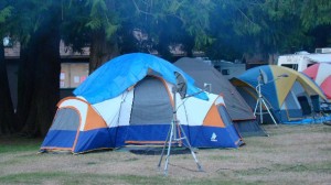
Only in Canada….

Canadian-style high tech camping!

Canadian-style high-tech camping!

😉

Average Rating: 4.5 out of 5 based on 162 user reviews.